Persaud Lab
BASIN (Basin Amplification Seismic INvestigation)
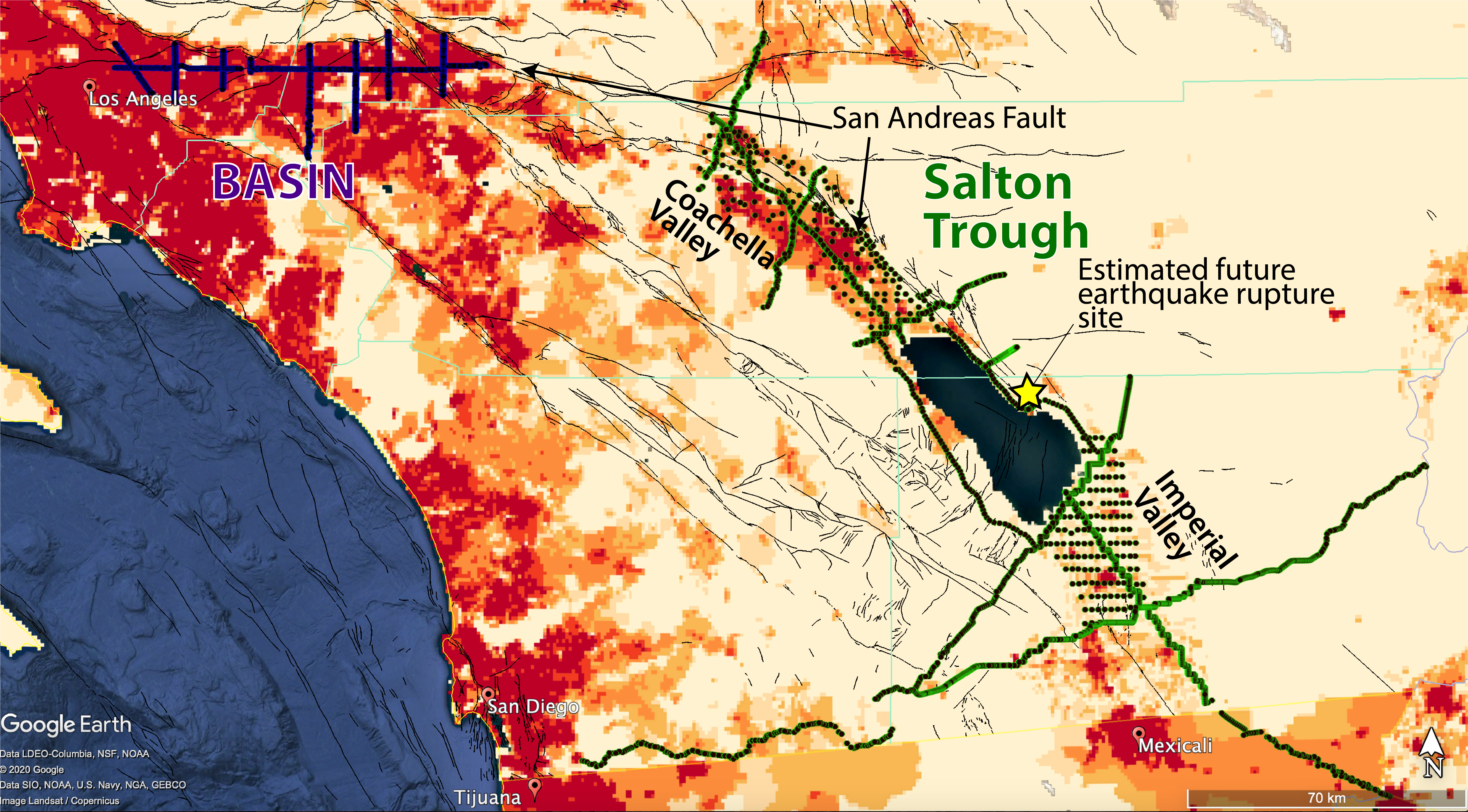
Population density map of Southern California (reds are higher population densities) with the BASIN surveys in the N. Los Angeles area (purple dots). The active source Salton Seismic Imaging Project in the Salton Trough (green dots) is also shown for reference. Black lines are faults.
Information on the logistics of our nodal deployments in 2017-2019 and initial results can be found here, in our IRIS Webinar, Urban Seismology in Megacities: the Los Angeles BASIN Experiment and in Clayton et al. (2019).
Rob Clayton's webpage has plots of local and teleseismic events and cross-correlations.
The 3-component data from the BASIN surveys are being used to construct a detailed 3D seismic velocity model toward the goal of better predicting strong ground motions in greater Los Angeles from events on the San Andreas fault.
- For a description of the ongoing receiver function studies see below.
- Ambient noise spectral ratio measurements will help constrain amplification and the depth to shallow interfaces with large impedance contrasts.
- Ambient noise correlations with the node stations and nearby SCSN stations produce Rayleigh and Love waves that are used to determine the shear wave velocity structure as well as local and long-range amplification effects in the basin.
- Finally, we will compare our velocity models and ground motion estimates to results obtained from the Southern California Earthquake Center Community Velocity Models (CVMs).
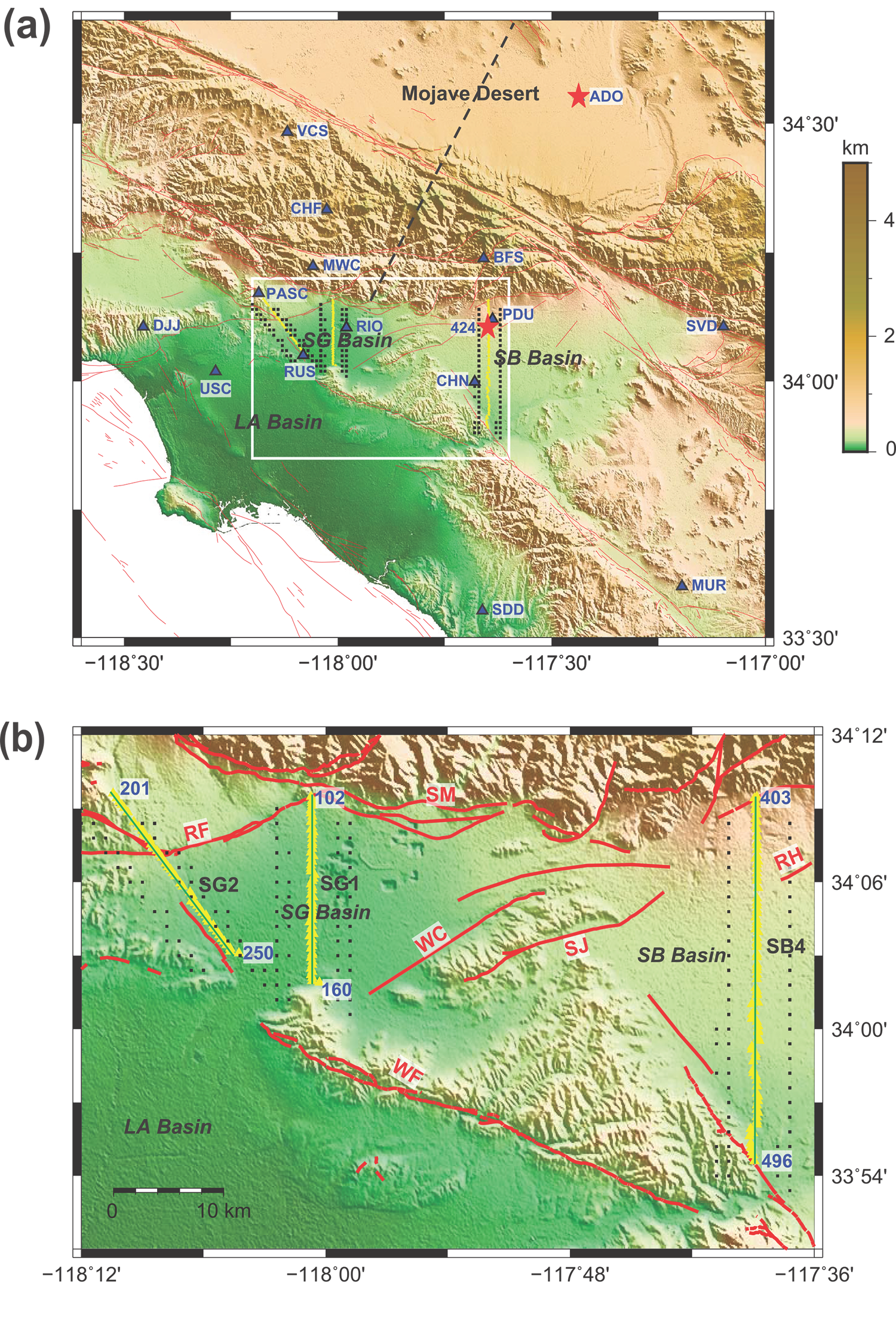
So far, we have use teleseismic receiver functions computed from three of the BASIN lines (Fig. 1), to map the depth and shape of the sediment–basement interface and to identify possible deep fault offsets. The results are published in Liu et al. (2018) and show the Moho discontinuity, the bottom of the basement, and intermediary sedimentary layers. There are also indications of midcrustal offsets along strike of the Red Hill and Raymond faults. The results are compared with receiver functions from nearby permanent broadband stations and the 1993 Los Angeles Region Seismic Experiment (LARSE) profile. The images show that dense deployments of node-type sensors can be used to characterize basin structure in a noisy urban environment. Examples of our receiver function results along three BASIN lines are shown in Figure 2.
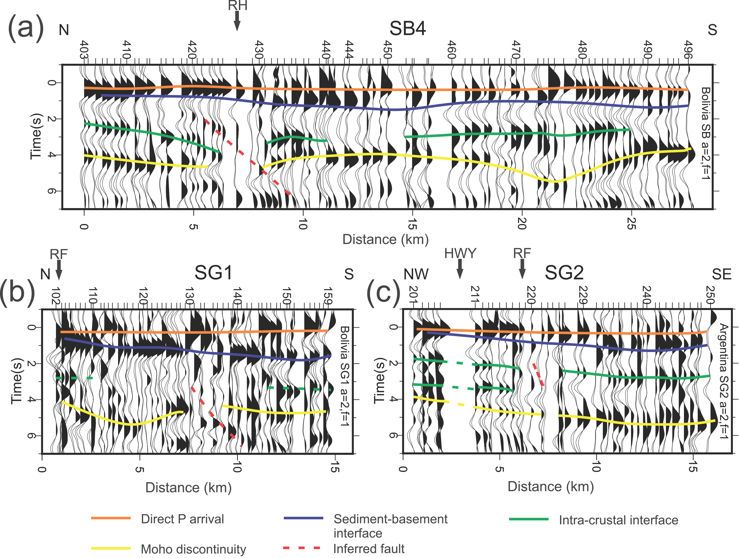
FIG. 2 Preliminary interpretations of three representative profiles of ∼1‐Hz radial-receiver functions from our nodal dataset along (a) the SB4, (b) the SG1, and (c) the SG2 lines. Profile locations are indicated by thin lines in Figure 1. RF, Raymond fault; RH, Red Hill–Etiwanda Avenue fault; HWY, Highway.
REFEREED PUBLICATIONS (See Publications for meeting abstracts)
**SRL Press release - "Urban Geophone Array Offers New Look at Los Angeles Basin"**